Circuit de la Sarthe measures 13.626 kilometres in its official homologated form. Our map trace of the same layout returned 0.793 kilometres. That is not a rounding error, and it is not a measurement failure. It is the entire editorial problem of Le Mans stated as a single contradiction: the circuit exists on the map as a permanent racetrack of under a kilometre, and it exists on race weekend as thirteen kilometres of asphalt that stops being a road and starts being a track for roughly a week each June. Everything interesting about Le Mans lives in the twelve-and-a-half-kilometre gap between those two numbers.
Methodology: What We Measured, and What the Map Would Not Give Us
We work from two data layers. The first is the official homologated length as published in the circuit's own documentation: 13.626 kilometres for the Circuit de la Sarthe used at the 24 Hours of Le Mans. That number is the legal length, the one lap timing is calibrated against and the one used to compute distance covered by a winning car.
The second layer is our own trace of the raceway geometry recorded in OpenStreetMap under the ODbL licence. When we pulled the geometry tagged as raceway for Circuit de la Sarthe, the polyline we got back returned 0.793 kilometres. That is not a broken export. It is the honest answer to a specific question: how much of the Sarthe layout is drawn on the map as a permanent racing facility.
The remaining twelve-and-a-half kilometres exist in OpenStreetMap too, but they exist as public roads — the D338 south of Le Mans, the D140 through Mulsanne, the connector back through Arnage. Those segments carry the tags of a road, not the tags of a raceway, because for fifty-one weeks of the year they are exactly that.
So the methodology here is not a comparison of two measurements of the same object. It is the observation that Le Mans, uniquely among the circuits Gridline traces, refuses to be a single object at all. We measured what the map is willing to call a racetrack. Everything past that boundary is the argument.
Finding #1: The 13.626 km Official Length Is a Composite of Two Legal Regimes
The 13.626 kilometres are not homologated as a continuous permanent facility. They are homologated as a composite: a permanent section under the jurisdiction of the circuit operator, and a set of public-road sections that are closed to civilian traffic under prefectural order for the race weekend and its trial days. This is the hybrid regime that the length figure hides.
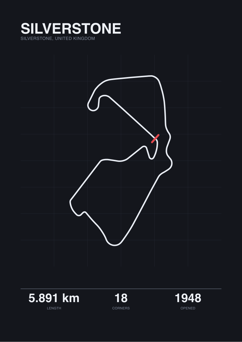
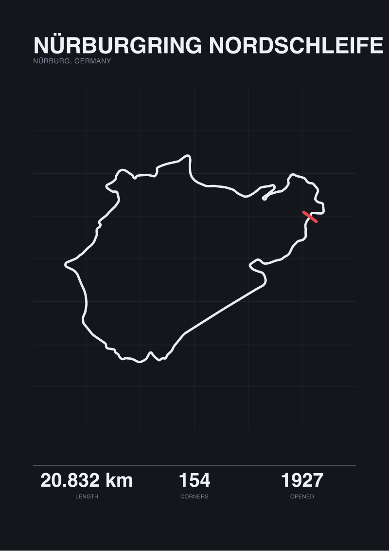
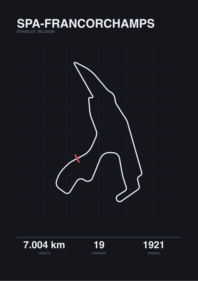
For context, the four circuits we hold in the current grounding set behave as single legal objects. Nürburgring Nordschleife is 20.832 kilometres of permanent racing facility, with an OpenStreetMap trace at 20.746 kilometres — a delta under one hundred metres, easily explained by centreline interpolation. Spa-Francorchamps runs 7.004 kilometres official against 6.995 kilometres traced, a delta of nine metres. Silverstone reports 5.891 kilometres against a 5.881 kilometres trace, again a delta of ten metres. Three fully permanent circuits, three sub-hundred-metre deltas.
Le Mans returns 0.793 kilometres against 13.626 kilometres. The delta is 12.833 kilometres. That is not measurement noise, it is legal noise: OpenStreetMap encoded only what is a racetrack under continuous ownership, and left the rest of the lap tagged as what it legally is — routes départementales that happen to host a race one week a year.
Once you see the layout this way, the length figure stops being a single number. It is 0.793 kilometres of dedicated permanent geometry plus 12.833 kilometres of public infrastructure temporarily borrowed. Every conversation about Le Mans that treats the 13.626 figure as equivalent to Spa's 7.004 or Silverstone's 5.891 is comparing objects that are not, structurally, the same kind of thing.
 Silverstone
The print from this article · from €29.95
View the print →
Silverstone
The print from this article · from €29.95
View the print →
Finding #2: The Mulsanne Straight Is a Public Road With a Racing Line
The Mulsanne Straight is the section that most readers picture when they picture Le Mans: a long, near-straight run down which prototypes historically hit their peak speeds of the entire year. It is also, on any Tuesday in November, a French D-road on which the speed limit is set by signposts, not by aerodynamic drag.
The straight forms part of the D338, the departmental road that connects Le Mans to Tours. When we look at the OpenStreetMap tags for the segment during a normal week, we get a road classified for public use with all the associated attributes of a rural French highway: shoulder, lane markings, junctions with local access roads, addresses fronting the tarmac. When the race weekend arrives, prefectural order closes the D338 to civilian traffic for the necessary hours, temporary barriers replace the roadside, the two ends are sealed with entry points controlled by circuit marshals, and for the duration of the closure that stretch is a racetrack.
Nothing about the underlying geometry changes. The corners at either end of the straight — Mulsanne Corner at the south, the flow through the Playstation and Michelin chicanes inserted along the straight in the 1990s for safety reasons — are drawn into the road itself. The chicanes are permanent kerbs and painted lines that road cars drive through the rest of the year at legal road speeds.
This is why the Mulsanne is not comparable to a straight like Kemmel at Spa or the Hangar Straight at Silverstone. Those are engineering choices made inside a purpose-built facility. Mulsanne is a road that a race weekend inherits. Its length, its cambers, its drainage crown and its adjacent tree line are all inputs the race accepts, not decisions the race made.
Finding #3: The Permanent Section Is Barely a Fifth of the Lap
The 0.793 kilometres of permanent racetrack the map returns is not a random sliver. It corresponds to the section around the pit straight, the Ford chicanes, and the run up to the Dunlop Bridge — the geometry that has been continuously enclosed as a racing facility since the circuit's early consolidation. This portion sits inside the Bugatti Circuit, the shorter permanent layout that shares its start-finish infrastructure with the Sarthe and hosts events year-round.
As a fraction of the full Le Mans lap, that permanent section is 5.8 percent. Put differently: a car completing a lap of the Sarthe spends roughly 94 percent of the distance on roads that are, by their legal classification for most of the year, not racing surface at all.
This ratio is the reason the character of a Le Mans lap resists comparison. Nürburgring Nordschleife runs 20.832 kilometres and 154 turns of continuously permanent facility — every metre of it exists to be driven fast. Spa's 7.004 kilometres and 19 turns are permanent. Silverstone's 5.891 kilometres and 18 turns are permanent. Each of those is a purpose-built environment where the driver's inputs are met by an environment designed to receive them.
At Le Mans, for 94 percent of the lap, the environment was not designed to receive them. The camber is highway camber. The kerbs, where they exist outside the permanent section, are temporary. The run-off is whatever the D-road provided plus whatever fencing the organisers erect. The racing line is one interpretation, laid onto a surface whose primary interpretation is transit.
Finding #4: The Hybrid Layout Has No Real Peer in Modern Racing
Hybrid road-and-facility circuits used to be the dominant form. Spa itself, in its 1921 opening configuration, ran to more than 14 kilometres on public roads through the Ardennes. The old Nürburgring Nordschleife, opened in 1927 and still 20.832 kilometres today, was originally conceived at a scale that only public-road use could support. Circuits of the 1920s and 1930s were mostly this shape: villages, valleys, ordinary roads, closed for a weekend.
Modern racing has moved almost entirely away from that regime. Spa in its current form is a fully enclosed 7.004 kilometres. The Nordschleife retained its 20.832 kilometres of length but is now an enclosed permanent facility under continuous ownership. Silverstone at 5.891 kilometres was built on a decommissioned airfield in 1948 and never had a road-borrowing phase. The trajectory has been one-way: from public-road hosting toward purpose-built enclosures with permanent run-off, permanent barriers and permanent liability regimes.
Le Mans did not follow that trajectory. It kept the hybrid. What it built instead was a set of localised interventions — the chicanes on the Mulsanne, the reprofiled Dunlop, the Porsche Curves as permanent complex — that treated the layout the way a restorer treats an old building: keep the shell, upgrade what is unsafe. The circuit's identity is inseparable from that decision. If Le Mans were rebuilt as a fully permanent 13.626 kilometre facility on the same footprint, it would not be Le Mans. The public-road inheritance is not a legacy quirk; it is the point.
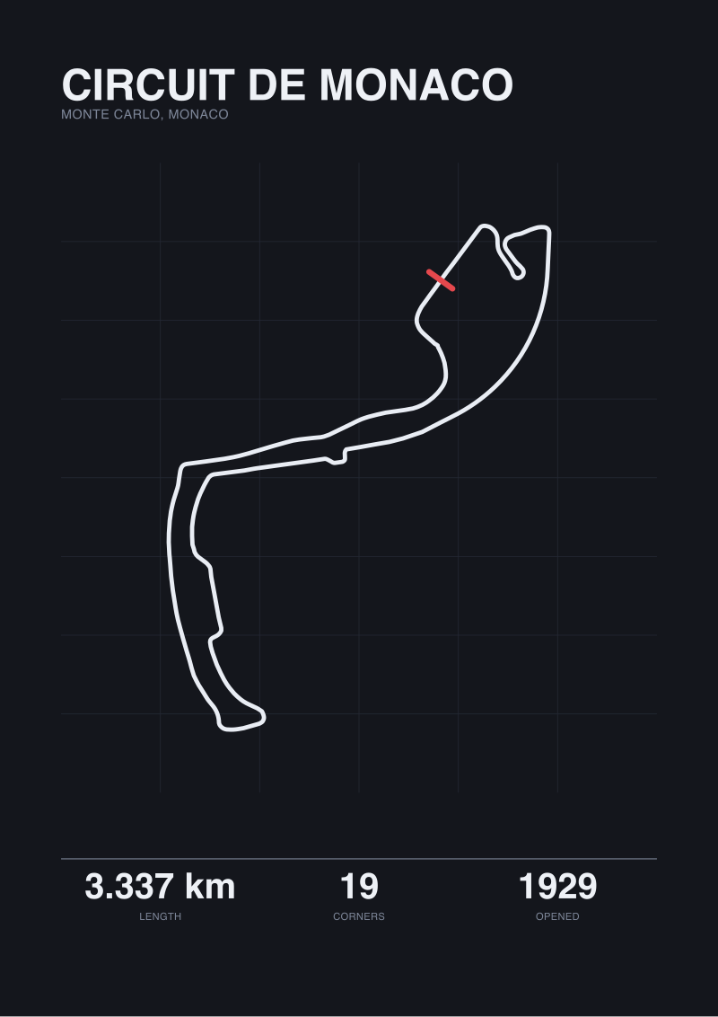
That is why the closest comparable object is not another modern race track. It is Monaco — another hybrid, another set of public roads, another prefectural closure order. But Monaco is 3.337 kilometres of tight urban street. Le Mans is 13.626 kilometres of rural highway. They share a legal regime and share nothing else.
| Circuit | Official length (km) | Map-traced raceway (km) | Delta (km) | Permanent facility? |
|---|---|---|---|---|
| Circuit de la Sarthe | 13.626 | 0.793 | 12.833 | Partial |
| Nürburgring Nordschleife | 20.832 | 20.746 | 0.086 | Yes |
| Spa-Francorchamps | 7.004 | 6.995 | 0.009 | Yes |
| Silverstone | 5.891 | 5.881 | 0.010 | Yes |
 Circuit de Monaco
The print from this article · from €29.95
View the print →
Circuit de Monaco
The print from this article · from €29.95
View the print →
What This Does NOT Prove
The 0.793 kilometre trace does not mean that 94 percent of Le Mans is unsafe, unprepared or amateur. The public-road sections of the Sarthe receive substantial modification for race use — temporary barriers, marshal posts, medical placement, resurfacing work in the weeks before the event — and the closure regime under prefectural order is enforced with a rigour no purpose-built facility needs. Calling those twelve-and-a-half kilometres "public road" is legally accurate and operationally reductive at the same time.
Nor does the map trace tell us what fraction of the lap is fast, or hard, or decisive for lap time. Time and distance are different questions, and grounding here does not include lap time data for the Sarthe or corner-by-corner speed traces. The 5.8 percent permanent-section figure is a spatial fraction, not a temporal one, and readers should not treat it as a claim about where a lap of Le Mans is won.
The Takeaway
Le Mans is the only circuit in our current set where the length figure and the map-traced geometry disagree by more than an order of magnitude, and that disagreement is the circuit itself — a permanent racetrack of 0.793 kilometres wearing 12.833 kilometres of public road for one week a year.
FAQ
Why does the map only return 0.793 km for a 13.626 km circuit?
Because OpenStreetMap tags features by their legal, everyday classification. The 0.793 kilometres are what is continuously classified as raceway — the enclosed permanent section around the pit straight, the Ford chicanes and the run to Dunlop, which is also the Bugatti Circuit used year-round. The remaining 12.833 kilometres are tagged as public roads, principally the D338 and D140, because that is what they are for the fifty-one weeks of the year the race is not running.
Which parts of the Sarthe are actually public roads?
The Mulsanne Straight runs along the D338, the departmental road from Le Mans toward Tours. The section south through Mulsanne village and out toward Indianapolis and Arnage runs along the D140. The permanent racing infrastructure — the pit complex, the Ford chicanes, the Dunlop area — sits at the north end of the lap and is what remains open as the Bugatti Circuit throughout the year. Everything between Tertre Rouge and the Porsche Curves is public road under prefectural closure during race week.
How does Le Mans compare to Spa or the Nordschleife in permanency?
Spa's 7.004 kilometres and the Nordschleife's 20.832 kilometres are both fully permanent facilities under continuous ownership. Our map traces returned 6.995 kilometres and 20.746 kilometres respectively — deltas of under one hundred metres, consistent with normal centreline interpolation. Le Mans returned a 12.833 kilometre delta, three orders of magnitude larger, because the underlying legal regime is different: partial permanent facility plus temporary road closure, not a single enclosed circuit.
Is the Mulsanne Straight the same road cars drive on normally?
Yes. The Mulsanne Straight is a stretch of the D338, a French routes départementales open to standard road traffic outside of race periods. The permanent chicanes installed along the straight in 1990 are drawn into the road itself, and civilian traffic passes through them at posted speed limits year-round. What changes on race weekend is not the road but its legal status: a prefectural closure order removes public access for the necessary hours and hands the surface to the circuit organisers.
Has the Sarthe layout been shortened over time?
The Circuit de la Sarthe has been reprofiled multiple times, most notably with the addition of the two chicanes on the Mulsanne Straight in 1990 to reduce peak speeds, and with earlier modifications to the Dunlop area and Porsche Curves. The current homologated length of 13.626 kilometres reflects those changes. Grounding here does not include the historical length series, so we can confirm the layout has evolved but will not put a precise figure on the earlier configurations.
Is Le Mans a street circuit like Monaco?
Legally, the closest parallel is Monaco: both use public roads under a temporary closure order rather than a fully permanent enclosed facility. Structurally, they are unlike each other in almost every other respect. Monaco is 3.337 kilometres of tight urban streetscape lined with kerbs and buildings. Le Mans is 13.626 kilometres of rural departmental highway through farmland and forest. They share a regime and share nothing else about the driving experience or the geometry.
Why does the article say "0.793 km" instead of listing all corners?
Because the grounding we have for the Sarthe reports its official length but does not report a verified corner count. The 154 turns figure for the Nordschleife or the 19 for Spa comes from established public documentation; the equivalent figure for the Sarthe is not in the data we work from here. Rather than publish a number we cannot source, we describe the geometry we can measure and name the corners that are broadly established public record. Honest limits, in our view, read as authority.
Where can I see the Le Mans layout as a print?
Our studio traces the Sarthe from the same OpenStreetMap geometry described in this article, then draws it as a print in the Gridline house style. The full range of circuit prints, including Le Mans, is at see the Silverstone print.
From the collection
New circuits and 10% off your first print.
One email now with your code. No noise after.