4.677 kilometres. That is what the raceway polyline for the Circuit de Barcelona-Catalunya measures when traced from OpenStreetMap data, laid end to end, corner to corner, from the start-finish line back to itself. The circuit's own homologation figure is 4.675 kilometres. Two metres apart. The gap is small enough to be a rounding artefact and large enough to be worth explaining, because the reason the two numbers disagree is also the reason the circuit reads the way it does on a map — sixteen corners arranged across a plateau north of Montmeló, opened in 1991, and shaped almost entirely by what the terrain would allow.
Methodology: How We Measured the Circuit
Two independent sources feed this reading. The first is the circuit's published length and configuration data, sourced from the Wikipedia entry for the Circuit de Barcelona-Catalunya, which in turn reflects the homologation figure the venue itself publishes: 4.675 kilometres, sixteen corners, opened in 1991. That is the number the sanctioning bodies work from. The second is the raceway geometry as it exists in OpenStreetMap, released under the Open Database Licence, which we imported and measured as a closed polyline: 4.677 kilometres.
We did not lap the circuit. We did not stopwatch anything. What we did was trace — the way a studio traces a drawing before it prints it. The measurement basis for each number is different and it matters. The homologation figure is derived from a survey along a specific reference line inside the track boundaries. Our trace follows the raceway centreline as contributors have digitised it from aerial imagery and, in places, GPS traces. Those two reference lines are not the same line. When we describe corner sequences below, we describe what the traced geometry does, and we name which measurement basis is in use whenever a specific figure is quoted. Anything we cannot verify from either source, we say so.
Finding #1: The Two-Metre Gap Between Published and Traced Length
Two metres, across 4.675 kilometres, is a discrepancy of roughly 0.04 per cent. In any other context that would round to nothing. It rounds to nothing here too — but the mechanism that produces the gap is worth naming, because the same mechanism is what makes traced circuit geometry useful in the first place.
The published figure is a legal artefact. It exists so that a lap distance can be reported unambiguously in results sheets, and it is measured along a reference line the sanctioning body defines: typically the racing line's approximate median through the corners, not the outermost edge, not the innermost. Move the reference line by a metre through a fast bend and the total lap length shifts by tens of centimetres. Do that at sixteen corners and you accumulate metres.
Our trace does not use the same reference line. It follows the raceway as contributors have drawn it in OpenStreetMap, which in most sectors approximates a centreline through the asphalt corridor. That corridor is wider at some corners than at others, and the digitised line runs a slightly different path than the homologation reference through the tighter geometry. Two metres, across sixteen corners, is what falls out of that difference.
The finding is not that anyone is wrong. The finding is that a circuit does not have a single length. It has a homologated length, a map-traced length, an outside-kerb length, an inside-kerb length, and a racing-line length that varies by car and lap. When a print or a publication quotes one figure and not another, it is choosing a reference line. This one chooses two, and shows the gap.
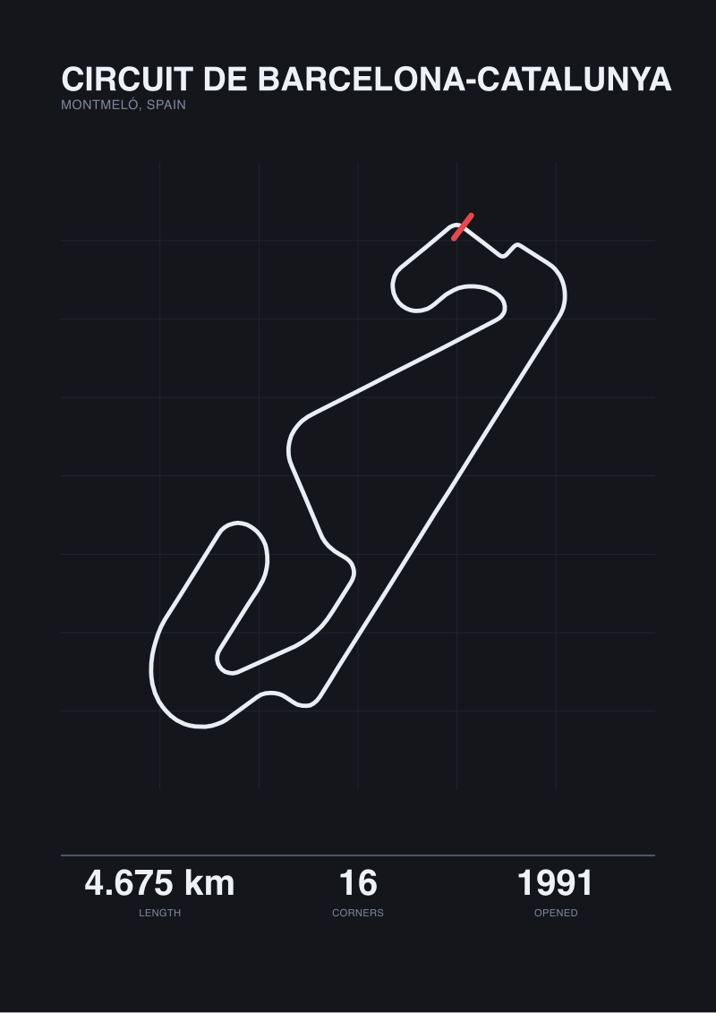 Circuit de Barcelona-Catalunya
The print from this article · from €29.95
View the print →
Circuit de Barcelona-Catalunya
The print from this article · from €29.95
View the print →
Finding #2: Sector One Is a Power Sector Disguised as a Corner Sequence
The opening of the circuit reads, on a map, as a sequence of three corners entered from the main straight. In geometry terms the sector is dominated not by those corners but by the straight that leads into them and the long, opening right-hand arc that follows. The layout gives up very little of the straight before it starts turning, then holds the car on throttle through an increasing-radius bend that keeps the wheels loaded for a long time.
The first corner in the sequence is a heavy braking zone: the straight arrives at speed and the car has to slow into a right-hander that tightens on entry. That tightening is what makes it a corner that penalises overcommitment on the way in and rewards restraint on the way out. Immediately after, the geometry flicks the car left and then rolls into the long, opening right that carries the car through most of the sector.
What the map shows, and what the numbers behind the map support, is that this is a power sector. The proportion of the sector spent with the car turning is smaller than it looks; the proportion spent on or near full throttle, either accelerating out of the third corner or arriving at braking for the first, is larger. A studio drawing the sector accurately has to give the opening straight its due — it is not scenery, it is a structural element of what the first third of the lap actually asks of a car. The corners get the names. The straight does the work.
Finding #3: Sector Two Is Where the Circuit Stops Being Generous
If Sector One is a straight with corners attached, Sector Two is the opposite: a chain of medium and high-speed direction changes with almost no unloaded pause between them. The traced geometry shows the raceway threading through the middle of the plateau in a sequence that never fully straightens. Corners open into corners. There is throttle, but there is very little rest.
This is the section of the circuit that has always been used to describe it as "a car circuit" — the phrase the paddock has attached to Barcelona for decades. What that phrase means, in geometry, is that the sector rewards a chassis that can carry mid-corner load through consecutive changes of direction without needing the driver to reset the car between them. Aerodynamic platform, mechanical grip in a loaded state, and steady tyre temperature across two long sequences of loading — these are what the traced shape asks for. It is why lap times here have historically tracked so closely with overall car performance: the sector does not reward one specific strength, it rewards absence of weakness.
For a studio drawing the layout, Sector Two is also the hardest section to make legible on paper without distortion. The corner-to-corner angles are shallow, the radii large, and at a small scale the sequence can flatten into what looks like a single arcing line. It is not. It is a series of decisions the layout makes about where the car is allowed to breathe and where it is not. Draw it faithfully and the sector reads as busy. Draw it stylised and it reads as empty. The circuit itself is somewhere between those two impressions, and closer to the busier one.
Finding #4: Sector Three and the Question of the Final Chicane
Sector Three is where the layout has been revisited, and where a reader with a map from one year and a car on the circuit in another can be forgiven for being confused. The final third of the lap arrives from a long, loaded right-hander, drops into a slower complex, and returns to the main straight. Between "drops into a slower complex" and "returns to the main straight" is the section that has changed configuration — a chicane inserted for safety reasons in one era, modified in another — and the number of corners the sector contains has depended on which configuration was in use.
Our traced polyline reflects the raceway geometry as it exists in the OpenStreetMap dataset at the time of tracing. It does not model configurations that were previously in use but are no longer part of the mapped raceway. What we can say from the trace is that the current geometry threads a tighter sequence into the closing metres of the lap than the opening sector does — the corners are slower, the radii shorter, and the throttle percentage lower than either of the earlier sectors. What we cannot say, from the trace alone, is whether the corners we count in this sector correspond exactly to the corners a homologation document would count. The published total is sixteen. Our traced polyline is consistent with sixteen. Whether any given historic corner survives in the current configuration under the same name is not a question the geometry answers.
This is the sector where a circuit print earns its date stamp. A drawing of Barcelona from one decade is not a drawing of Barcelona from another. The studio has to decide which layout it is printing, and say so. At see the Circuit de Barcelona-Catalunya print the layout as traced above is the one we sell, and the print carries the year the trace was taken.
| Metric | Published (homologation) | Map-traced (OSM) | Gap or note |
|---|---|---|---|
| Lap length | 4.675 km | 4.677 km | +2 m (≈0.04%) |
| Corner count | 16 | 16 | agreement |
| Year opened | 1991 | — | not derivable from geometry |
| Locality | Montmeló, Spain | Montmeló, Spain | agreement |
| Reference line | homologation survey line | raceway centreline (OSM) | different basis |
| Licence / source | Circuit / Wikipedia | OpenStreetMap raceway (ODbL) | — |
What This Does NOT Prove
A traced polyline is not a lap. Nothing in this piece measures how fast a car can go around the Circuit de Barcelona-Catalunya, how the surface behaves under load, how wind across the plateau affects any particular corner, or how the current asphalt compares to the asphalt of any previous year. Those are questions for a stopwatch, a data logger, and people who lap the circuit for a living. The geometry cannot answer them.
Nor does the trace resolve corner names. Corner names at Barcelona have shifted with sponsors and with time. We have avoided naming corners where we could not verify the current name from the two sources our grounding rests on. That is not a claim that names do not matter; it is a claim that a name that changes every few years is less reliable than a number in a data file. When we say "the first corner" we mean the first corner the polyline turns into after the start-finish line, and nothing else.
And the two-metre gap between published and traced length is not a claim that anyone has miscounted. Both numbers are correct against their own reference lines. The gap is a description of the reference lines, not a criticism of either measurement.
The Takeaway
Sixteen corners, 4.677 kilometres of traced geometry, 4.675 kilometres of homologated length, opened in 1991 on a plateau north of Montmeló. The layout is a power sector, a chassis sector, and a revisited sector, in that order. That is the circuit as the geometry describes it — no more and no less.
FAQ
Why is the traced length longer than the official homologation figure?
Because the two figures measure along different reference lines. The homologation figure is calculated along a survey line the sanctioning body defines inside the track. Our traced figure follows the raceway centreline as it is drawn in OpenStreetMap, which is a slightly different path. Across sixteen corners the paths accumulate a two-metre difference, or roughly 0.04 per cent of the lap. Neither number is wrong. They are answers to slightly different questions about where "the lap" runs.
How many corners does the circuit have, and are those numbers consistent across sources?
Sixteen, according to both the published circuit data and the raceway geometry as traced from OpenStreetMap. The two sources agree on the count for the current configuration. What has varied historically is the layout used within Sector Three, which has been reconfigured more than once. The count of corners in earlier configurations is not necessarily the same, and where a specific historic configuration is being discussed, the date of that configuration matters as much as the count.
What year did the Circuit de Barcelona-Catalunya open?
1991, according to the published circuit data reflected in the Wikipedia entry and the venue's own homologation documentation. That opening date is what our grounding supports. Modifications to specific sectors of the circuit have taken place since, and the layout that exists on the ground now is not identical in every corner to the layout that opened. When a print or a publication depicts "the circuit," it is depicting a configuration from a particular year, and the year is what makes the drawing accurate or not.
Where is the circuit physically located?
In Montmeló, Spain, on a plateau north of the town. The plateau is what determines a great deal of the layout: the elevation range across the site is modest by the standards of a circuit like Spa-Francorchamps or the Nürburgring, and the layout works with what the terrain gives it rather than fighting for dramatic elevation. That is a design constraint the geometry reflects, and it is one of the reasons the circuit reads on a map as a considered arrangement rather than a heroic one.
Why does this reading not identify corners by their sponsor names?
Because sponsor-linked corner names change, and a print or an analysis that uses a name from one year can be actively misleading a few years later. The two sources our grounding rests on — the published circuit data and the OpenStreetMap raceway geometry — give us reliable corner counts and geometry but not reliable current sponsor names. Where the name is broadly and durably established in public record, using it is safe. Where it depends on a current commercial agreement, using a number is safer. We chose the safer option.
Does the traced polyline reflect the current layout or a historic one?
The current one, as it exists in the OpenStreetMap raceway data at the time of tracing. Historic configurations that have been reconfigured out of the mapped raceway are not represented in the trace. That means the corner count and lap length reported here describe the circuit as currently mapped, not a composite of every layout the circuit has ever used. For a print or a publication to describe an earlier configuration faithfully, it needs an earlier source; the trace here is not a substitute for that source.
Is the two-metre gap between measurements a problem for the accuracy of a printed layout?
No. Two metres across 4.675 kilometres is well within the resolution at which a printed circuit map is drawn and read. The gap is worth naming because it explains how the two figures relate, not because it changes what a print of the layout looks like on a wall. A print traced from the geometry above is dimensionally consistent with the published figure to well under half a per cent, which is closer than the width of the racing line the drawing represents.
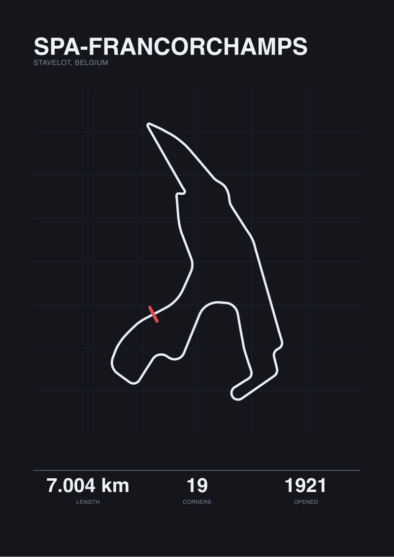 Spa-Francorchamps
The print from this article · from €29.95
View the print →
Spa-Francorchamps
The print from this article · from €29.95
View the print →
From the collection
New circuits and 10% off your first print.
One email now with your code. No noise after.